


bergfex: hiking & tracking app for iPhone and iPad
Developer: bergfex GmbH
First release : 25 Sep 2015
App size: 269.96 Mb
The bergfex: hiking & tracking app is a must-have for every hike, ski tour or other outdoor activity.
Find the most beautiful hiking trails in your area or create personal tours with our route planner and track all your outdoor activities. Precise GPS navigation, detailed hiking maps for the entire Alpine region and other useful features bring you safely to your destination.
Get to know the bergfex hiking app for free!
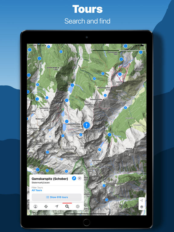
FIND HIKES OR SKI TOURS THAT SUIT YOU
The bergfex tours app contains around 200,000 hiking trails, ski tours, running routes and mountain bike trails throughout Europe. Detailed tour descriptions, topographic hiking maps for the entire Alpine region and filter options make it easy to find the ideal tour.
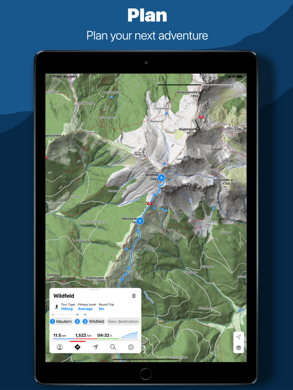
TOUR PLANNER AND HIKING NAVIGATION
You havent found the perfect hiking or ski tour yet? Then use the bergfex tour planner. In just a few steps you can create your personal hike and let it navigate you to the summit. The precise GPS hiking navigator wont let you down even in the mountains.
DETAILED MAPS
Our maps for the entire European Alpine region come from OpenStreetMap (OSM). This means that when planning your route and while hiking, you can be sure that you will find the right route thanks to regularly updated maps.
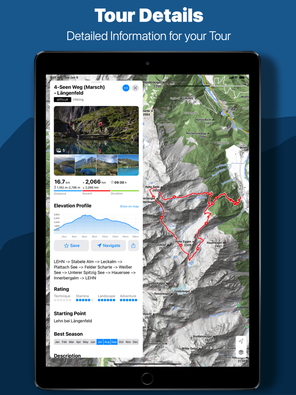
TRACKING HIKING ROUTES AND TRAILS
Track the distance covered while hiking, ski touring, running or mountain biking and get comprehensive statistics such as duration, altitude metres, elevation profile, distance and speed. A heat map shows you all the activities you have recorded so far.
ROUTE AND FITNESS TRACKING COMBINED
Keep track of your fitness level and activities! Optionally, you can wear a Bluetooth heart rate monitor while hiking, ski touring or other sports to get even more detailed information about your fitness level.
APPLE HEALTH, GARMIN CONNECT, POLAR FLOW, WEBSYNC AND GPX-IMPORT
Your hikes and planned tours are automatically synchronised with your bergfex account. Tracked activities are also displayed in the Apple Health app, Garmin Connect and in Polar Flow. Self-created routes can be exported and imported via GPX file.
_____________________
TEST MANY PRO FUNCTIONS FOR 7 DAYS FREE OF CHARGE & WITHOUT ANY COMMITMENT
Register in the hiking app and test the helpful functions of our PRO subscription on your next hike:
• more detailed map material thanks to higher zoom level
• warning signal when leaving the route
• overlay to visualise slope steepness >30°, 35°, 40°, 45°
• official hiking maps such as ÖK50, SwissMap, etc.
• offline map material for navigation even without an active internet connection
• satellite map with additional information and points of interest
• intermediate destinations for route planning
• zones for heart rate measurement
• hiking, ski touring and more without advertising
_____________________
ANY QUESTIONS?
If you have any questions or comments about our app, please send us an email at: [email protected]
Note: Continuous GPS usage can result in a severe reduction in battery life.
Terms of use: www.bergfex.at/agb
Privacy: www.bergfex.at/datenschutz